If you’re not familiar with German geography, there’s an area in Bavaria that doesn’t consider itself as part of Bavaria at all. It considers itself as entirely seperate (and of course, better) than the lederhosen-wearing, weird-talking yokels of the deep south of the state….and that area is Franconia.
Historically, while Munich (capital of Bavaria) was still a nondescript village somewhere down close to the alps, Nuremberg (capital of Franconia) was already a thriving metropolis, trade center, and a seat of power.
Alright, I admit I might be slightly biased having grown up in Franconia, but I still think the people here are much more approachable and a lot nicer than the arrogant southlanders residing in Munich…but I digress.
Franconia has a lot of hiking opportunities and even markets itself as one of the premium outdoor destinations in Germany.
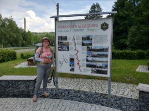
One of those destination trails is the Franconian Mountain Trail (Fränkischer Gebirgsweg), a roughly 435km / 271mi long-distance hiking trail that covers various mountainous regions in the northeast of Bavaria/ Franconia.
I have decided to tackle this trail as part of my PCT preparation (start date is only about a month away – yikes) and I plan to finish the whole trail in less than two weeks . usually it takes about three weeks for the average hiker.
That means I’ll have to cover 30-36km (19-22mi) every day without taking time off. (Spoiler alert> it didn’t work out that way😂). Even though ‘wild’ camping technically isn’t allowed in Germany, I’ll try to spend as many nights out in the wilderness as possible. Finding a spot to sleep might be the biggest challenge…
So if you’d like to follow along the journey through the different regions (Frankenwald, Fichtelgebirge, Fränkische Schweiz, Nürnberger Land), keep on reading below.
Day 1: 27 May 2018 – Blankenstein to Rodesgrün – 14,5km
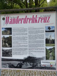
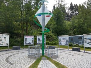
After a leisurely morning at home I had the luxury to get a ride to the starting point of the trail, a small town on the border of Franconia and Thuringia – Blankenstein. This is the place where the Rennsteig begins, probably one of the best known German trails, as well as three other major trails that head off in different directions. That’s why they built the ‘Turnstile of Hiking’ at the meeting point of the trails with informational boards and a small monument.

It was right around noon that I headed out and it was pretty hot and muggy. Although there weren’t any rains or thunderstorms in the forecast I was a bit worried, but oh well, what can you do, right?
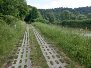
For the first few kilometers the trail follows the ‘Green Band‘, which is a renatured area that serves as a refuge for plants and wildlife. This area was created when Germany was unified in 1990, after it had been seperated into two different countries for almost 50 years since the end of WWII.
The former border (turned sanctuary) stretches along almost 1400km and is a powerful reminder of history. It’s kind of an eery feeling to walk along a stretch of earth where less than 30 years ago you would have been shot on sight. But it’s also inspiring…if only every area of conflict could have such a peaceful resolution…
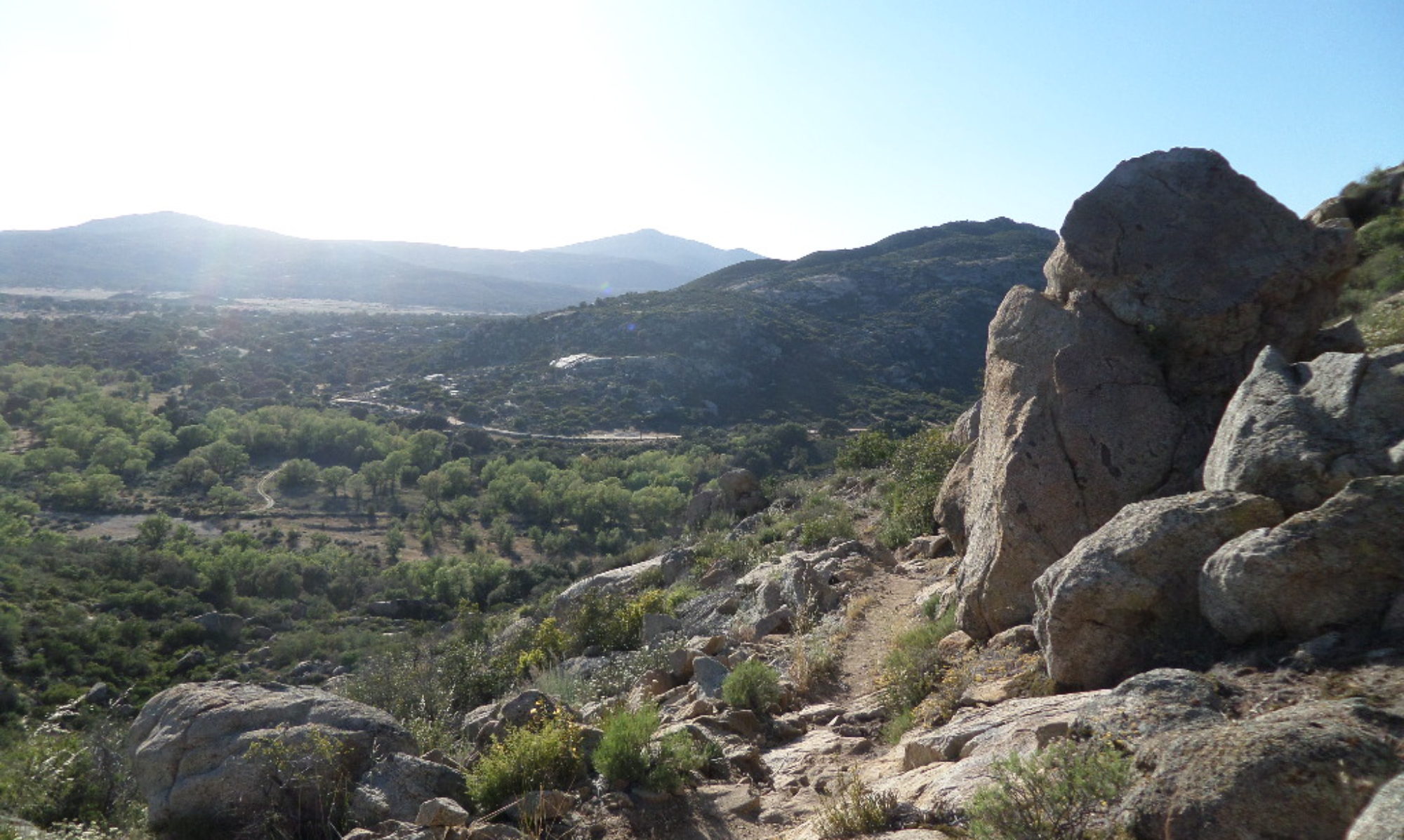
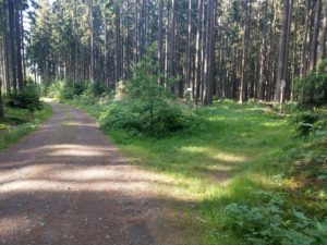
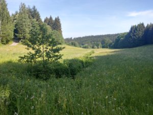
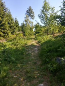
After about an hour walking along the border you turn fully toward Bavaria (Franconia, but who wants to squabble) and climb a bit, walking through forest and meadows, through fields and tiny villages. It’s a pleasent walk, nothing spectacular, but still nice enough to not get boring.
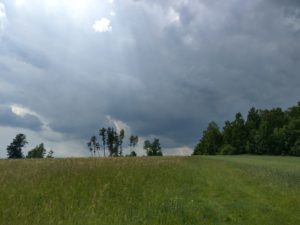
Clouds were continuing to build as I walked, but I was still stubbornly refusing to believe that the storm would hit me…..well….it did. Right while I was walking across an open field with only a small tree for cover. So I huddled there for about a half hour. Not the smartest decision, to be sitting under a lone tree in a thunderstorm, I know….but it seemed better than continuing to walk.
Once the rain slowed to a drizzle and I couldn’t hear thunder any more I continued on…though not very far. By the time I reached the next town it started to thunder and rain harder again. Thankfully, in the middle of town they had built a wooden pavilion next to a stream, which is where I hung out for the next 2 hours waiting for the thunderstorm to pass. And goog thing too, because when the thunder is strong enough that you feel the wooden bench under your butt vibrating, you do NOT want to be walking in THAT.
By the time I was able to move on it was already 5 pm so I was sure that my goal for the day wwould be unattainable. I was walking in full rain gear, but of course just now after the rain the trail led through overgrown fields and soggy meadows, completely soaking my feet and shoes.
So I had to make a decision…..and I ended up booking a room in a small guesthouse for 26€. The price was great, but that’s about it….the bed was way too soft and warm, the beer was warm and the food bland and almost cold.
But at least it was dry and I was able to dry out all my stuff overnight.
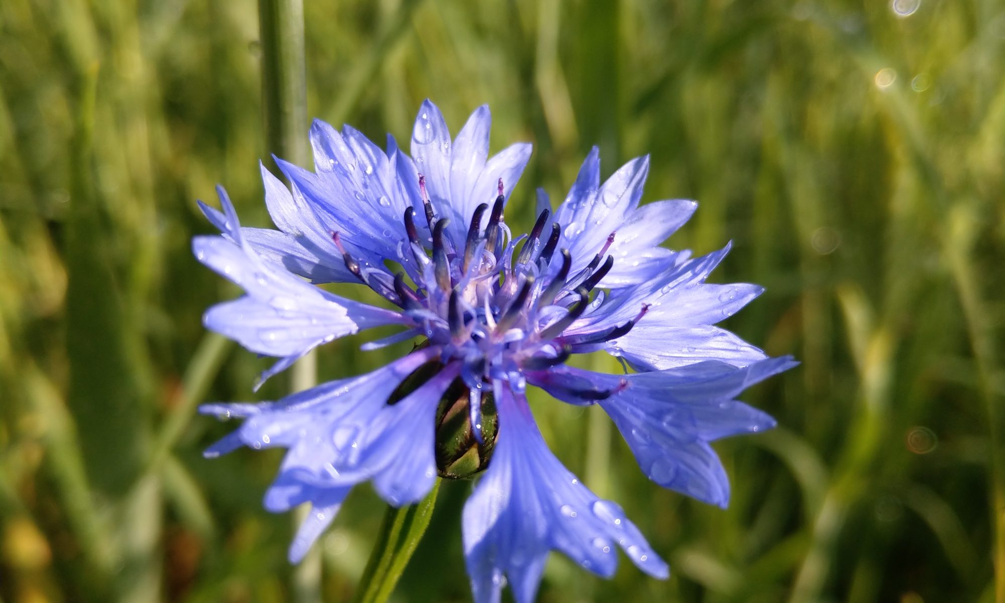
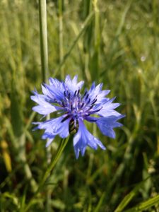
And one thing I have to say for thunderstorms….they sure leave some pretty raindrops behind 🙂 .
Day 2: 28 May 2018 – Rodesgrün to Haidberg – 36km
Breakfast (once I finally got it) was pretty decent and I was able to set out at around 7:30am, trying to make up some miles I had wanted to do yesterday. The walking was pretty smooth all day, not much elevation change, but A LOT of roadwalking or very hard-packed dirt roads. Not so much fun for my feet, especially after being soaked for a few hours yesterday.
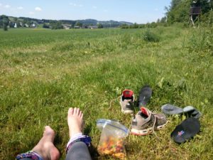
At 11:30 I took a break, dried out my feet some more, took care of a blister and had some snacks. I was 14km into the day and feeling good. Even though the trail today hit way too many small villages for my liking it was still pretty.
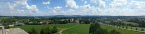
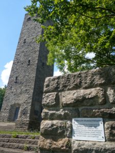
Just before Münchberg I climbed the 120+ steps up a tower to get a nicer view of the surrounding hills (I can’t really bring myself to calling them mountains) and then descended into the city and escaped the afternoon heat for a few hours while enjoying an ice-cold beer. So good 🙂 .
By the time I hit the trail to get out of town it was 5pm and I still had quite a ways to go. I stopped briefly around 6:30pm to make some dinner, my feet were complaining a lot at this point…but I kept on trucking. Just putting one foot in front of the other, knowing that I’d get to where I wanted to go eventually.
I filtered some water out of a small creek that ran between fields (not ideal because of fertilizer residue) and pushed out the last climb of the day while the sun was slowly setting.
I did find the perfect spot to put up my shelter though, away from any roads, in a sheltered spot behind some trees, on the soft mossy ground. Just perfect. And exactly what I needed after this long and exhausting day. I did feel pretty good though, considering I had never walked this far in a single day before.
I settled in and slept pretty well, even though the moon shone like a flashlight and brightened up the night considerably.
Day 3: 29 May 2018 – Haidberg to Ziegelhütte – 12km
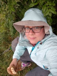
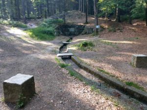
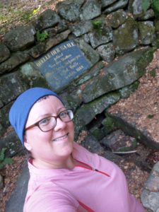
My feet were pretty sore this morning, but otherwise I felt great. I got up at 6, had a quick breakfast of honey wafers and headed out, passing through Zell, where the morning traffic was surprisingly loud and annoying, and started the climb up to the Waldstein. On the way I passed the wellspring of the river Saale. I dumped out the creekwater I still had left over from yesterday and filled up on delicious, fresh, crisp spring water, before starting the final ascend up the mountain.
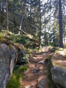
On the way up I passed an old bear trap, a stone building that really was used to catch bears in the late middle ages which were then presented to the ruling lord for sport hunting.
I didn’t stop at the restaurant on top of Waldstein and instead continued on, partly limping along…until around 1:30pm. Since the weather forecast for the next few days promised severe thunderstorms I decided to take a few days off to wait them out (and also to let my blisters heal). So I caught a bus, a train and another train and got home around 5pm.
All in all I managed about 60km in a little over 48 hours, not too shabby. But I’ll really have to step up my game if I’m ever gonna make it on the PCT.
So until I return to this trail, this is the end of the adventure so far.
Until next time….keeping you posted…
Congrats on the longest single day distance sweety! Enjoy the time off, and get back with even more drive! :*
Thanks love 😍 I’ll get back out there tomorrow